


3D Aerial Surveying
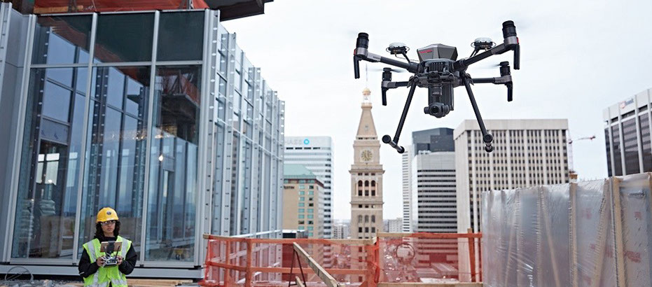
Drones can perform construction tasks usually done by humans more quickly, more accurately and with less equipment.
Drones can perform construction tasks usually done by humans more quickly, more accurately and with less equipment
Drones can perform construction tasks usually done by humans more quickly, more accurately and with less equipment.3
How Are Drones Used In Construction?
Currently, there are several ways that drones are being used in construction, including:
Electronic distance measurement
High resolution aerial images and GPS
Light detection and ranging (lidar)
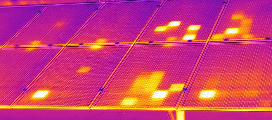
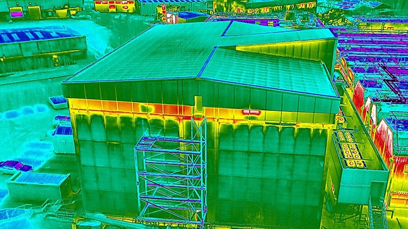
Collector of Internet of things (IoT) data and as an IoT endpoint
Examples of what these use cases look like in real life include:
Jobsite mapping: Pre-construction topographic surveys can lead to more accurate project estimates.
Terrain modeling: High resolution aerial images and GPS data can improve earthwork volume tracking/quantity takeoffs.
Progress tracking: During construction, topographic surveys can monitor progress, keeping construction crews and clients on the same page. It can also help detect problems before they lead to major rework.
Site surveillance and security: Monitor job sites and equipment, especially for high-risk work environments, e.g., dealing with contamination or potential for contamination.
Site Scan Drone Images Integrated with BIM Plans Boost Construction Quality and Profit
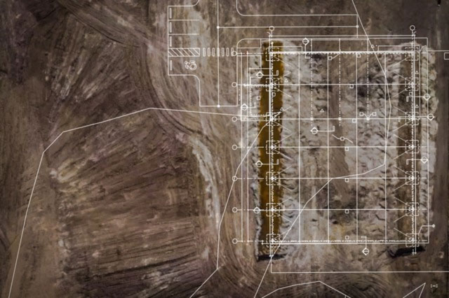
Our Team automatically flies a drone on site to capture orthomosaics -- aerial photographs that have been adjusted for topographic relief, lens distortion, and camera tilt so that they can be used to measure true distances -- that are now integrated with BIM models to immediately identify as-built conditions that aren't following the model or schedule.
SERVING NEW ENGLAND AND BEYOND


© 2018 Masons Commercial Construction,llc. All rights reserved. The MASONS logo AND components are trademarks of MASONS DRYWALL PLASTER & STUCCO and its affiliated companies.